
What is Where Is This Place
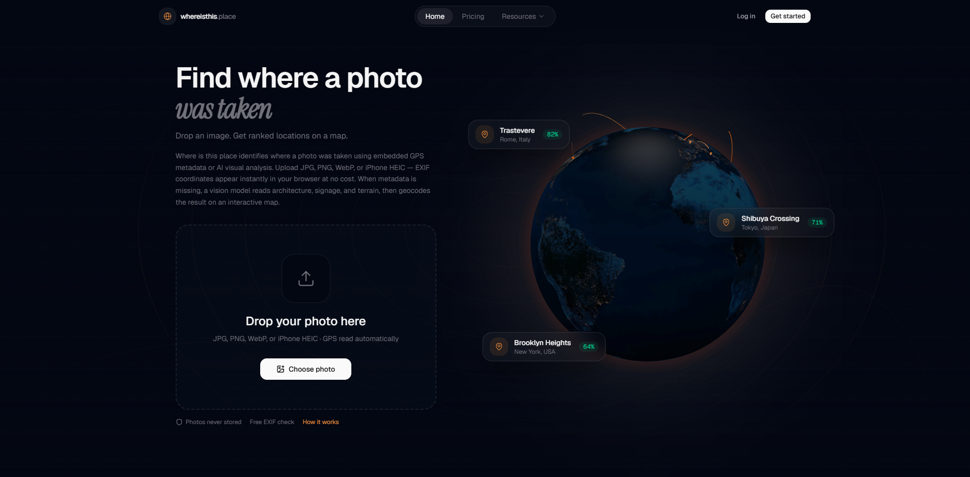
Where Is This Place is a privacy-first web tool that helps you find where a photo was taken. It offers two complementary methods: free EXIF GPS extraction that runs entirely in your browser, and AI-powered geolocation that analyzes visual cues in the image to provide ranked location predictions. The tool is designed for places, not people, and does not perform facial recognition.
Features of Where Is This Place
- Free EXIF GPS extraction: Reads GPS coordinates directly from photo metadata in your browser, with no server cost or credit required.
- AI geolocation: Analyzes visual cues to estimate location, returning multiple ranked predictions with confidence scores.
- Privacy-first: Images are processed in memory and discarded immediately; full-resolution photos are never stored.
- Supports multiple formats: JPG, JPEG, PNG, WebP, and HEIC (including iPhone HEIC files).
- No facial recognition: Built exclusively for geolocating scenes, not identifying people.
- OpenStreetMap integration: Resolves coordinates to place names.
Use Cases of Where Is This Place
- OSINT and journalism: Verify where a photograph was taken for source verification and investigative work.
- Personal photo organization: Determine the location of old or unknown photos.
- Travel and research: Identify landmarks or regions from images.
- Complement to reverse image search: Unlike Google reverse image search, which finds similar images online, this tool estimates location from scene content alone, even for novel photos.
Pricing
- Free tier: EXIF GPS extraction is always free with no account required. New accounts receive one free AI search credit on signup.
- Paid options: Additional AI searches use wallet credits or a Pro subscription. You only pay when you run AI analysis, never for metadata already in the file.
FAQ
How does AI photo geolocation work? The model analyzes visual cues in your image—architecture, signage, vegetation, terrain, and road markings—to infer where the photo was likely taken. It returns up to five ranked location predictions with confidence scores. Coordinates are then resolved to place names using OpenStreetMap geocoding.
What is EXIF GPS and why is it free? Many cameras and phones embed GPS coordinates directly in a photo's EXIF metadata. Where Is This Place reads that data locally in your browser before any upload, so there is no server cost and no credit charge. If GPS is present, you see the location instantly without running AI analysis.
Do you support HEIC photos from iPhones? Yes. HEIC files from iPhones are converted on our server with metadata preserved when possible. If the client cannot parse EXIF locally, the server reads GPS after conversion. For best results, ensure Location Services were enabled when the photo was taken.
Are my photos stored on your servers? No. Uploaded images are processed in memory and discarded immediately after analysis. We do not retain originals. Logged-in users may see a small thumbnail and result JSON in search history, but the full-resolution photo is never kept.
How accurate is AI geolocation? Accuracy depends on how visually distinctive the scene is. Urban environments with readable signage, unique landmarks, or regional architecture tend to score highest. Rural or generic scenes are harder. We always show multiple ranked predictions so you can judge confidence rather than relying on a single guess.
Can I use this for OSINT and journalism? Yes—that is a core use case. The tool is designed to help verify where a photograph was taken, not to identify people. Use it responsibly for geolocation research, source verification, and investigative work. See our Acceptable Use Policy for boundaries.
Is there a free tier? EXIF GPS extraction is always free with no account required. New accounts receive one free AI search credit on signup. Additional searches use wallet credits or a Pro subscription. You only pay when you run AI analysis—never for metadata already in the file.
Which image formats are supported? JPG, JPEG, PNG, WebP, and HEIC are supported for upload. EXIF extraction works when the file contains embedded metadata; stripped or edited images may lack GPS even if the original had it. Screenshots and social-media re-uploads often have metadata removed.
How is this different from Google reverse image search? Google finds visually similar pages on the web—useful when the exact photo already exists online. Where Is This Place estimates geographic location from scene content alone, even for novel photos never published before. The two approaches complement each other rather than replace one another.
What happens to EXIF data during AI analysis? EXIF is parsed in your browser first. If you proceed with AI analysis, coordinate hints from EXIF may be sent alongside the image to improve results—but only if you choose to analyze. We do not silently harvest metadata from files you only preview.
Can the tool locate photos of people or faces? No. The product is built for places, not people. We do not perform facial recognition or identity lookup. Acceptable use focuses on geolocating scenes—landscapes, buildings, streets—for research and verification, not tracking individuals.
Why might EXIF GPS be missing from my photo? Location tagging may be disabled in camera settings, stripped by messaging apps, removed by social platforms on upload, or lost during editing. Some privacy tools intentionally delete EXIF. If GPS is absent, AI geolocation remains available as a separate path.